
It passes mostly through pleasant flat pasture land and although in cuttings at the Mickleover end is mostly on embankments, which is fortunate as the surrounding farm land is prone to flooding and the small stream which it follows, eventually becoming Etwall/Hilton Brook, is not able to cope after heavy rain.
The whole length is part of the National Cycle Network, being both Route 54 and Route 68 until they diverge at Etwall.
Take a seat, we have a good five miles to go and 51 slides to get through.
 |
| Here we go then. Mickleover Station ahead. No car parking past this sign but more than adequate parking closer to Station Road. |
 |
| Through the barrier which prohibits motor cycles and other unauthorised vehicles. |
 |
| On the right we see the station, now a private house, and the Sustrans milepost. There are 1000 such cast iron mileposts on the National Cycle Network over the whole country. They were funded by the Royal Bank of Scotland which subsequently went bankrupt, but not for that reason. |
 |
A nice open stretch here, since this was once the site of a British Rail Research Depot, where development work was carried out for such things as the Channel Tunnel Railway.
On the site there were several buildings, since demolished, including an engine shed and a small gauge model railway enclosed in a long polytunnel. The concrete trestles on which the 5" gauge track was mounted can be seen over to the right hand side of the path.
At that time, the track between Mickleover and Derby was up-rooted and the section from here to Egginton was used as a test track. It was still connected to the rail network at the far end and rumour has it that it was used occasionally as an overnight parking place for the Royal Train.
|
 |
| For five miles now the path is generally fairly flat and straight with a good surface. There is a slight gradient of 1 in 100 downhill for some distance. |

 |
| There are not many access points along the Greenway, but this one leads up to the houses around the Honeycomb public house. |
 |
| And on the right, up the steps, a footpath leads across the fields to Hackwood Farm where there is a café. The path is not suitable for cycles. |
 |
| In 2012 serious flooding affected houses on the left here, (behind the hedge) and the sandbags are a temporary measure to prevent a recurrence. |
 |
| The fence on the left separates the path from the stream which lies on the other side. |
 |
| On the right, this magnificent oak tree which is over 300 years old, was here before the railway came, and in fact before Queen Victoria acceded to the throne. |
 |
| Opposite, the Sustrans Rangers have built these steps and a seat, where you can rest awhile to watch the activity on the bird feeders. |
 |
| Further on another seat, just before the crossing footpath, which leads, on the right, to Black Wood and Radbourne village. A nice walk but not suitable for cycles. The path on the left leads back into Mickleover at Greenside Court. |

The Greenway is marked at accurately measured mile points with large coping stones, all on the left side of the path. There are four of these, the fifth mile point being exactly at (guess what?) Five Mile Gate. |
The Greenway has four pairs of farm gates, at points which were originallyfarm crossings over the railway.
Three of them are named after adjacent farms. Here is Bonehill Gate the farm being hidden by trees.
The large gates are locked but the small ones are fastened with looped steel chains.
Please fasten the gates after passing through, as they are a barrier against farm animals which occasionally stray onto the path.
Not to worry however as, they are more likely to be sheep or lambs than cattle.
|
 |
The Greenway is an excellent place for joggers and is much used by them.
The grass verge along here is the habitat of a rare colony of glow worms which can be seen on dark nights during the Summer months.
|
 |
| Here is Bannel's Gate where the farm can be seen to the left. |

 |
| ...........Bearwardcote Gate (pronounced locally as "Berracut"). |
And next................................
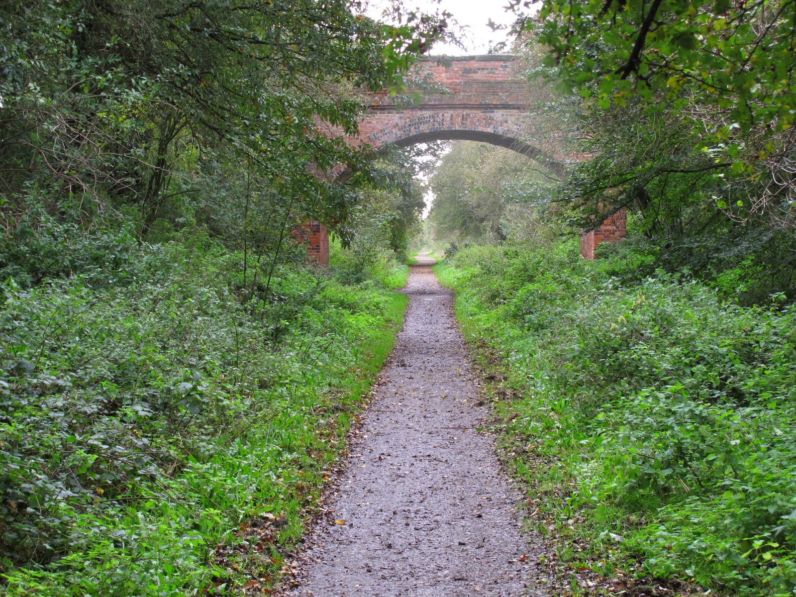 |
| There are several brick built bridges across the path. They carry only footpaths or farm tracks. This is Badgers Bridge, so called because of the nearby badger setts. |
 |
Here is the approach to Heage Lane Bridge, which carries the Greenway over Heage Lane. After construction of the bridge it was found that high loaded farm wagons could not pass beneath the arch, and since they could not raise the railway, they lowered the road. What a good idea, except that now being the lowest point, the road floods regularly after heavy rain.
To the right a path down to the road gives access to the "Eating Out" pub on the A516 road.
Turn left on reaching the road to pass beneath the bridge.
Turn right at the road to access Happy Hens Farm where there is a farm shop and café.
Beware of traffic as visibility is poor.
|
 |
| Here the deck of Heage Lane Bridge. The white blobs are rain spots on the camera lens. |

To the left are three houses which stand on land which was once the site of a coal gas works. Gas was made from coal delivered by rail and there was a small siding here.
The house in the picture was occupied by the gas works manager.The works were closed about 1904.
 |
| Here Hepnall's Bridge, again named after the nearby farm, which is now, after much building work, described as "Etwall Manor". |

And alongside steps leading to the footpath above, which runs between Etwall and Dalbury villages.

You will hear the sound of traffic here, since the main A516 (the Etwall by-pass) is directly ahead on an embankment behind the trees.
Construction of this road gave rise to the devious nature of the path in this area. If the traffic noise does not bother you, take a breather on yet another seat provided by the Rangers.

Then on towards..............
 |
| ...........the barrier where Routes 54 and 68 go their separate ways. The Pennine Cycleway is Route 68 going straight on via Ashbourne, Buxton, along the spine of the Pennines another 345 miles from here to Berwick-upon-Tweed, close to the Scottish border. |

Route 68 ahead ...........

.
.......... and to the left, passing beneath the A516 by way of this ugly modern concrete monstrosity of a bridge, is our way to Etwall.
 |
| Clear directions from the Sustrans milepost. Burton 7 miles, Derby 7 miles and Ashbourne 14 miles. |
 |
| On turning right after the bridge we are faced with two options. The right hand path takes us into Etwall village by way of Sutton Lane, and on the left we catch a glimpse of Sutton Lane bridge under which we are to pass. |
 |
| We will return here to Sutton Lane bridge after a loop through Etwall village, but for now, straight ahead. |
 |
| Phew! A tight fit for the handlebars here. |
 |
A straight and level run now after Sutton Lane Bridge, with John Port School grounds behind the banking on the left.
When the railway was built in 1866, the then owner of the land, Sir John Port, insisted that railway passengers should not be able to see his house, which occupied the site of the present school, and so this long embankment was constructed.
He also requested that the bridges should be screened by trees, which they are, and that the bridges should be "ornamental" which they are not.
However the magnificent Scots Pines in this area survive to this very day in spite of their great age.
|
 |
| At the end of the long embankment we come to the site of Etwall Station, of which there are no remains, after passing beneath the Pink Bridge, so named after a mistake in mixing the paint used to cover graffiti. |

It is, so far as we know, the only Pink Bridge in the UK, if not the world.

Just a small reminder of the heritage ........................

.......... and Shadwell, long lamented laborador who loved this place
 |
| Etwall Station stood here. Ahead on the left, is another access point, onto the new housing of Old Station Close. |
 |
| Further on comes Kingfisher Bridge, where you might be lucky enough to espy a kingfisher looking for a meal in the waters of Etwall Brook, which flows beneath the bridge. |

On now to pass beneath the A50 trunk road, which carries heavy traffic between the two Midlands motorways, the M1 and the M6.
Better down here than up there.

Another seat built by the Rangers...........................
 |
| ......... with this fine view opposite. |
 |
| And on to our final bridge, this one being Hargate Bridge, named after the adjacent equestrian centre. |
 |
| From this bridge we come to.......................... |


 |
| ....... and ahead the tall brick chimney marking the site of Egginton Creamery which used to manufacture cream from locally produced milk. The buildings now house a small engineering works. |
 |
The end of our ride is now in sight at Egginton Junction Bridge, with two options to join the A5132 road linking Hilton and Willington.
From the bridge parapet you can see Egginton Station, now a private house, and alongside a level crossing on the live railway which runs between Derby and Stoke-upon-Trent.
|
 |
| No ride to this point is complete without a visit to a favourite local café, that being Hargate Tea Rooms at Don Amott's Leisure Kingdom, a short ride along the A5132 in the direction of Hilton. |
Future posts will take us on from here, one returning to Mickleover by way of a loop of Etwall village, and the other onto the Hilton Greenway which is NCN Route 549, leading to Uttoxeter. A third will run further along Route 54 to Burton-on-Trent and the cathedral city of Lichfield.
Watch this space.